|
|
Archaeoastronomy DatabaseThe Archaeoastronomy Database is a crowd-sourced compilation of investigations and observations of astronomical connections that can be objectively demonstrated at ancient sites whether intended by the builders or not. The goal is to collect as much data as possible in a searchable and categorized format so that observations can build on one another and in aggregate might contribute to our overall knowledge of the past. (more...)
|
Swinside |
Swinside Stone Circle
|
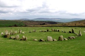
Swinside Stone Circle (also known as Sunkenkirk or Swineshead) is an amazing stone circle in Cumbria, England.
Proposed Astronomical Connections
As with any stone circle the number of stones at any angle produce virtually any alignment imaginable, but there are some specific features of the circle (notably the entrance) as well as a very distinctive horizon profile that are more conducive to demonstrating possible intentional alignments.
NOTE: Some of the sightlines have been slightly revised with better topographic data. Updates forthcoming.
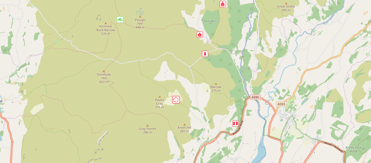
Swinside area and surrounding monuments from the Megalithic Portal Map
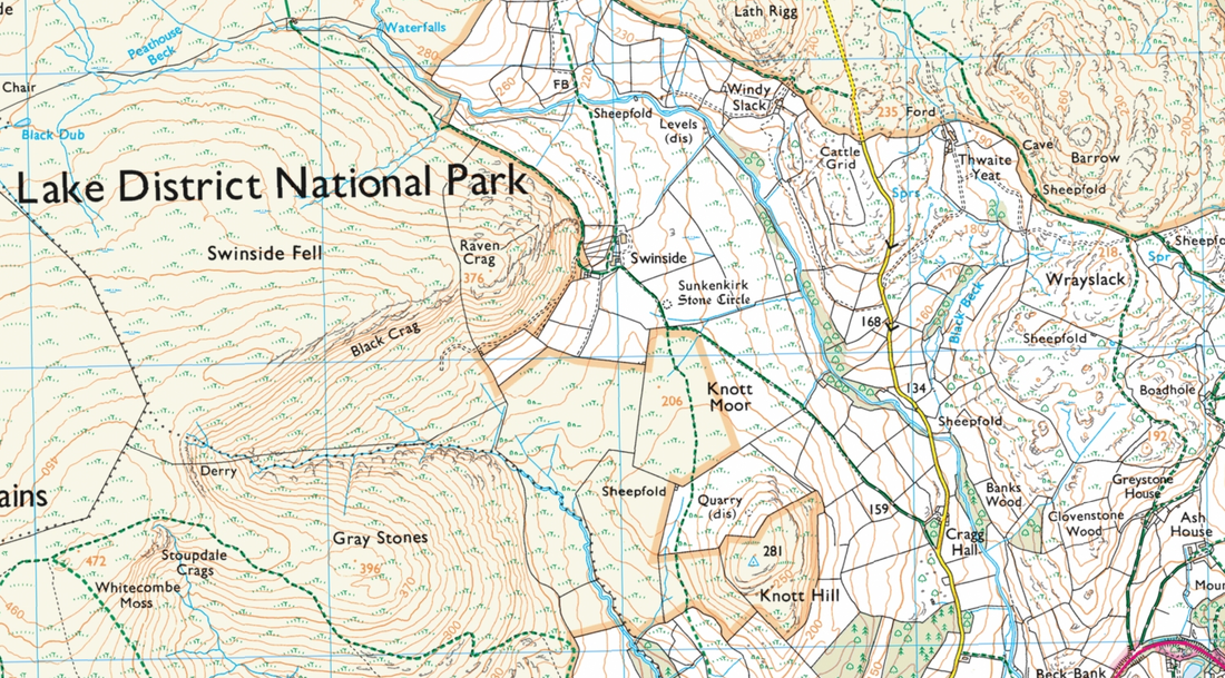
OS Map of the area with contour lines
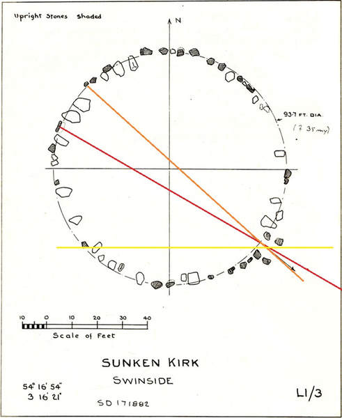
Overlay of Thom's plan showing additional proposal of equinox through the entrance stones.
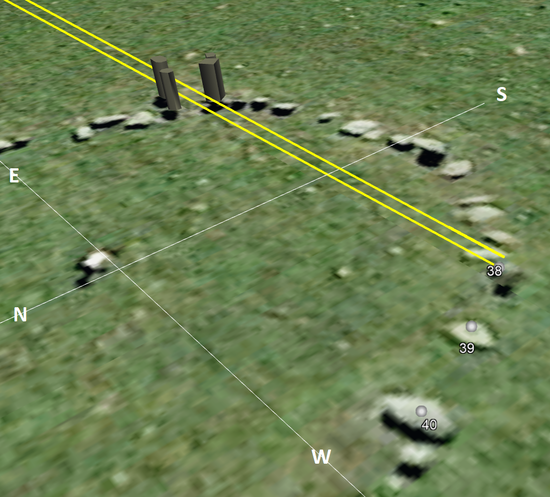
Google Earth detail of light from rising sun at Equinox entering the circle and probably striking stone 38.
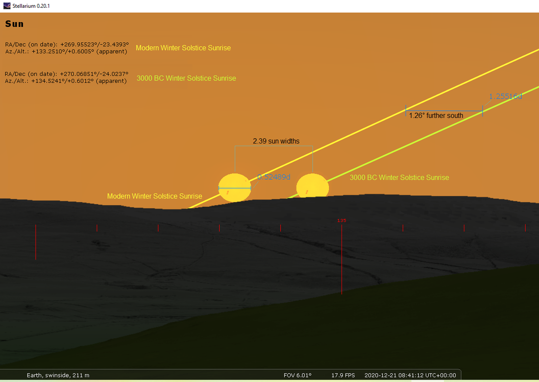
Stellarium visualization of Winter Solstice Sunrise (modern and 3000 BC) with Horizon data from David Hoyle: www.standingstones.org/
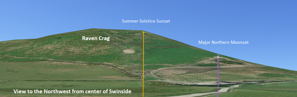
Google Earth view of approximate setting locations of the sun at summer solstice and the northernmost moon at major standstill.
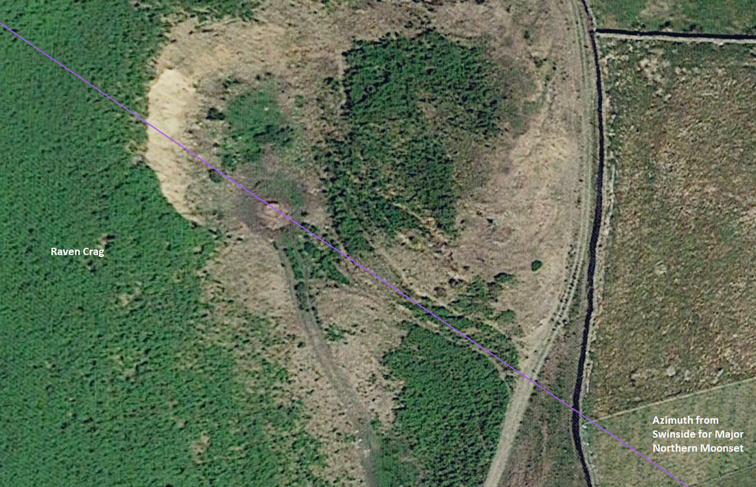
Major Northern Moonset Azimuth from the circle toward the direction of Raven Crag.
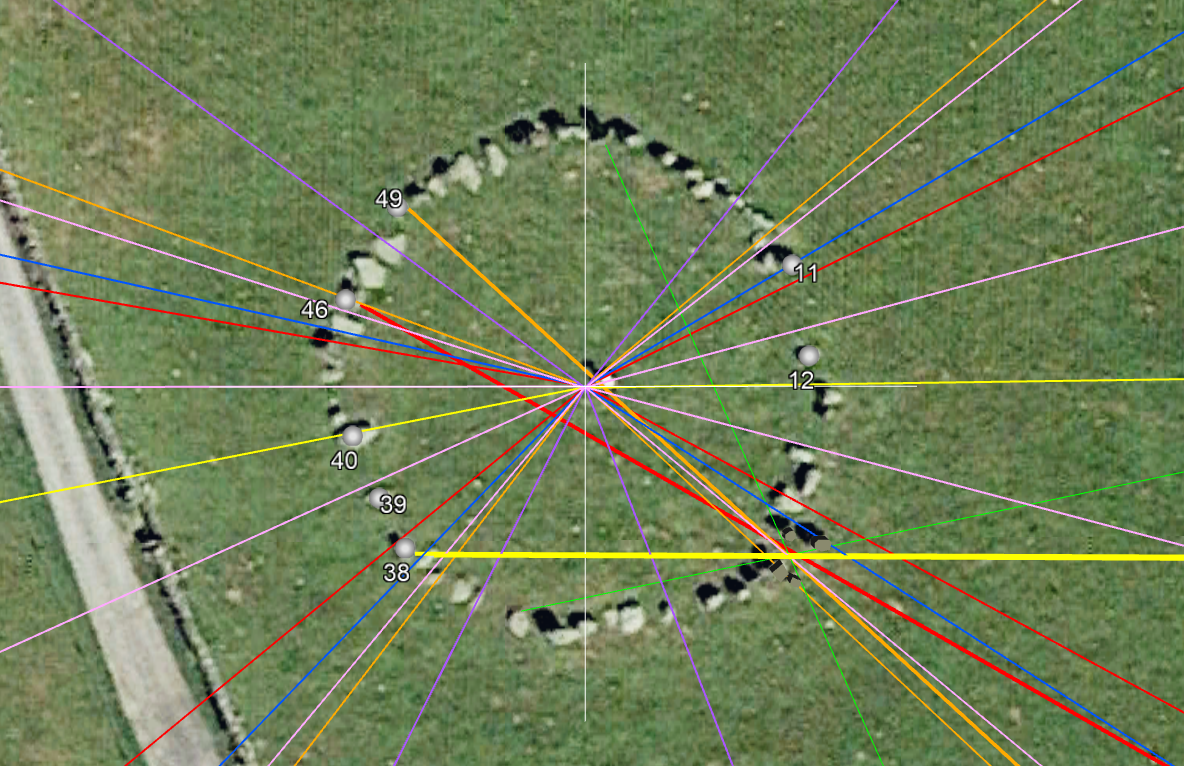
Google Earth Screenshot (all layers, a bit of a mess but they can be toggled on & off)
Base azimuths for major standstill, solstices, and cross-quarter days.
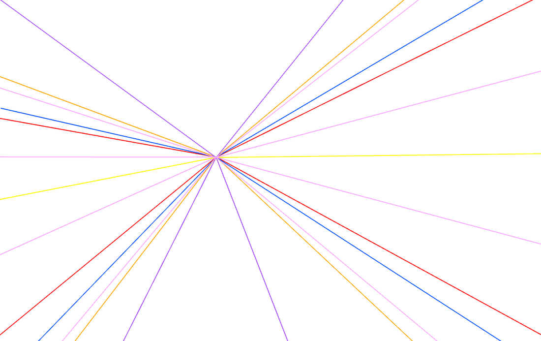
Horizon adjusted azimuths for major & minor standstills, equinoxes, solstices, cross-quarter days, and 16th intervals.
KEY: lavender, blue, yellow, orange, red, pink
BACK to the Archaeoastronomy Database MAIN PAGE
KEY: lavender, blue, yellow, orange, red, pink
BACK to the Archaeoastronomy Database MAIN PAGE
